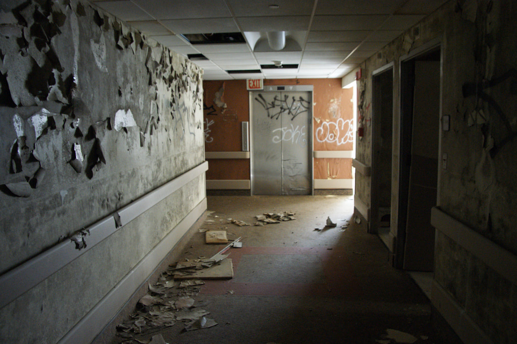
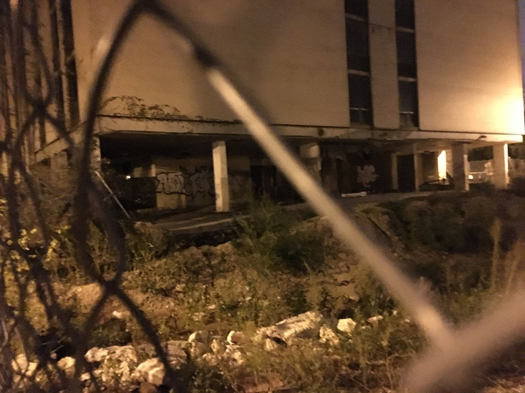
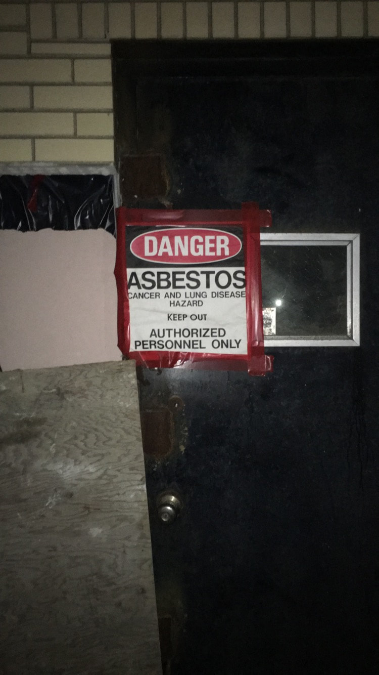
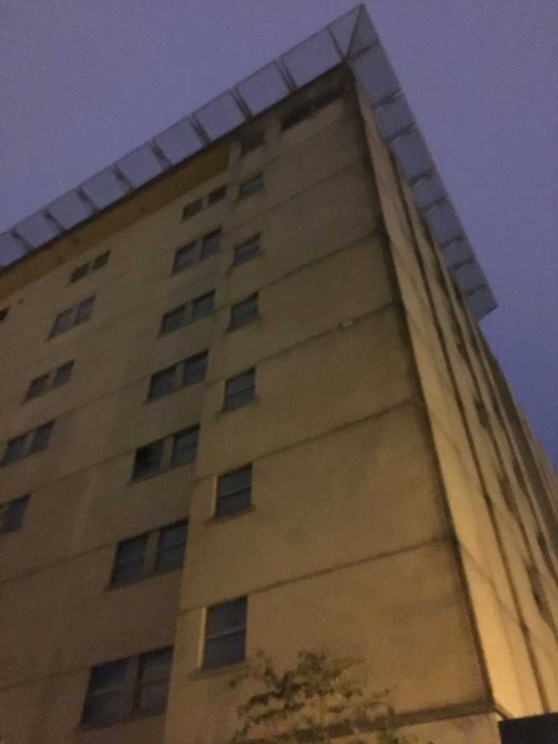
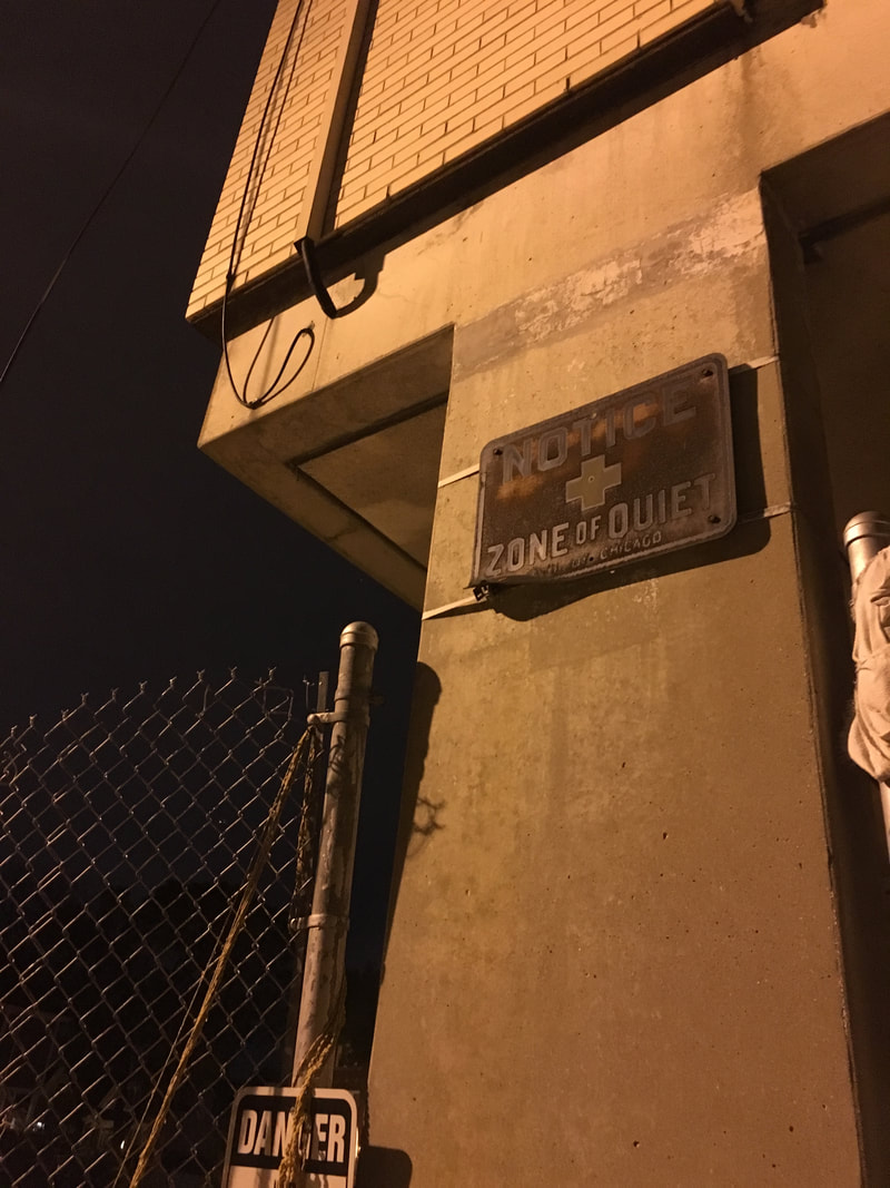
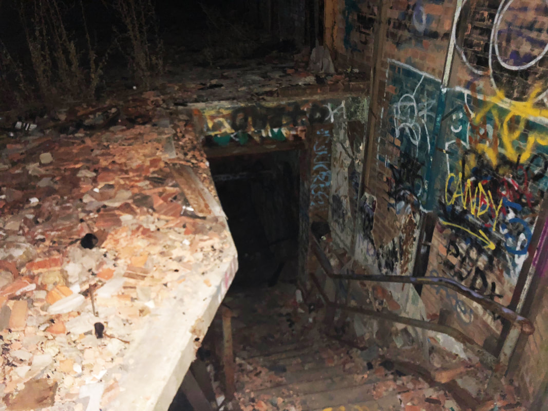
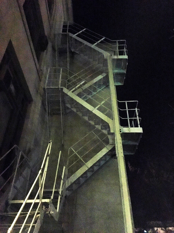
OverviewVisit this abandoned hospital (where Hillary Clinton was born!) by taking the red line to Bryn Mawr. Once you're there, walk to 5700 North Ashland Avenue and take a couple laps of the block to see how many people are outside. Usually, it's about a million. I swear, no one in this part of the city ever goes to sleep. They'll all be sitting on their porches waiting for you to walk by. If you're lucky and there's only minimal surveillance, sneak through the fence in the back and make your way in through the back of the building. There is a door, but if it's blocked off you can climb over a small brick wall to access an easier entrance through the east side of the building. Safety and RiskEdgewater is an easy place to get to, but not an easy place to get into. I visited the week before Halloween and was surprised by caution tape, screaming red signs, and archaic-looking metal plaques proclaiming the site's dangerous nature. I've never been somewhere so determined to scare you. It was wild. I've only made it inside the building once, and as soon as I was able to walk into the hospital lobby, I saw car headlights stopped outside and only narrowly escaped. Don't come here unless you're at least a little bit okay with the possibility of getting caught.
0 Comments
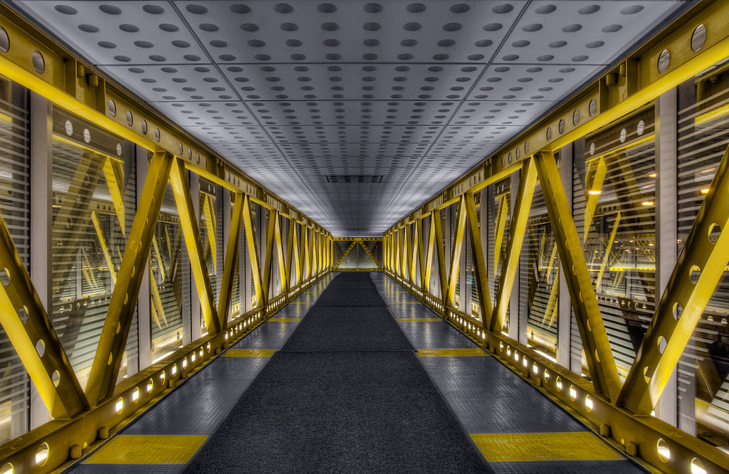
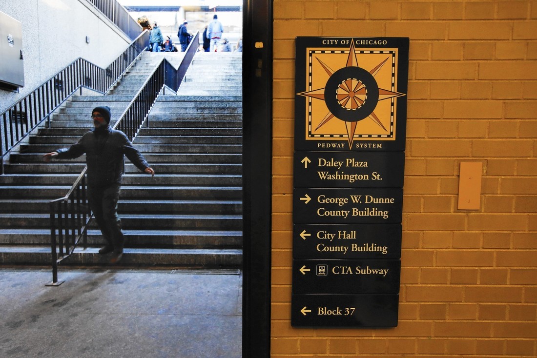
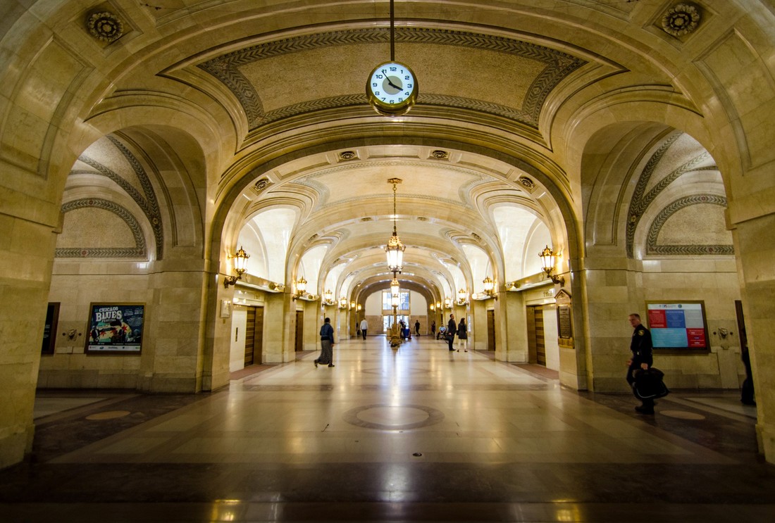
OverviewIf you're looking for a way to explore some underground tunnels that aren't illegal (imagine!), there's no better place than the Pedway. Chicago has a huge network of connected paths that will take you almost anywhere in the business district. Click here to see where it can take you - and enjoy traveling through a less-crowded, less-frigid Chi-town! (Disclaimer: Pictures above aren't mine... I ended up just taking video footage. See below!)
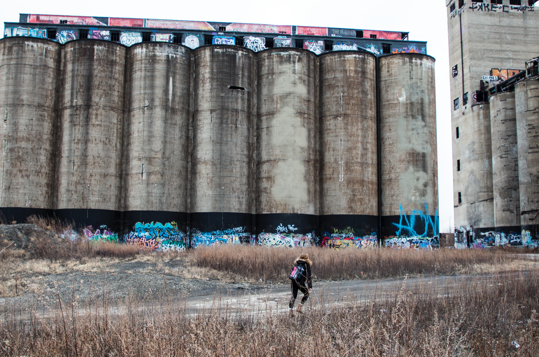
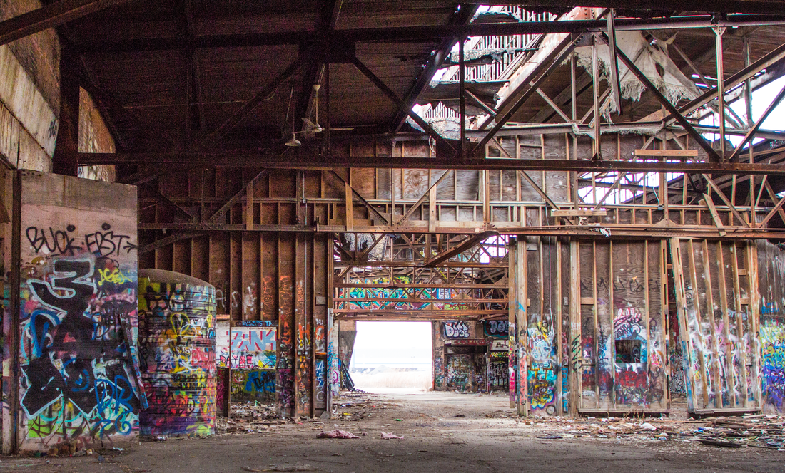
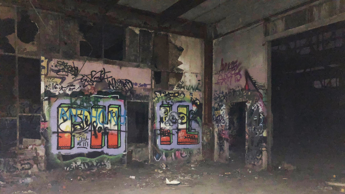
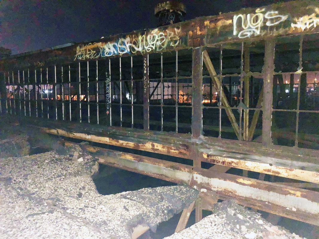
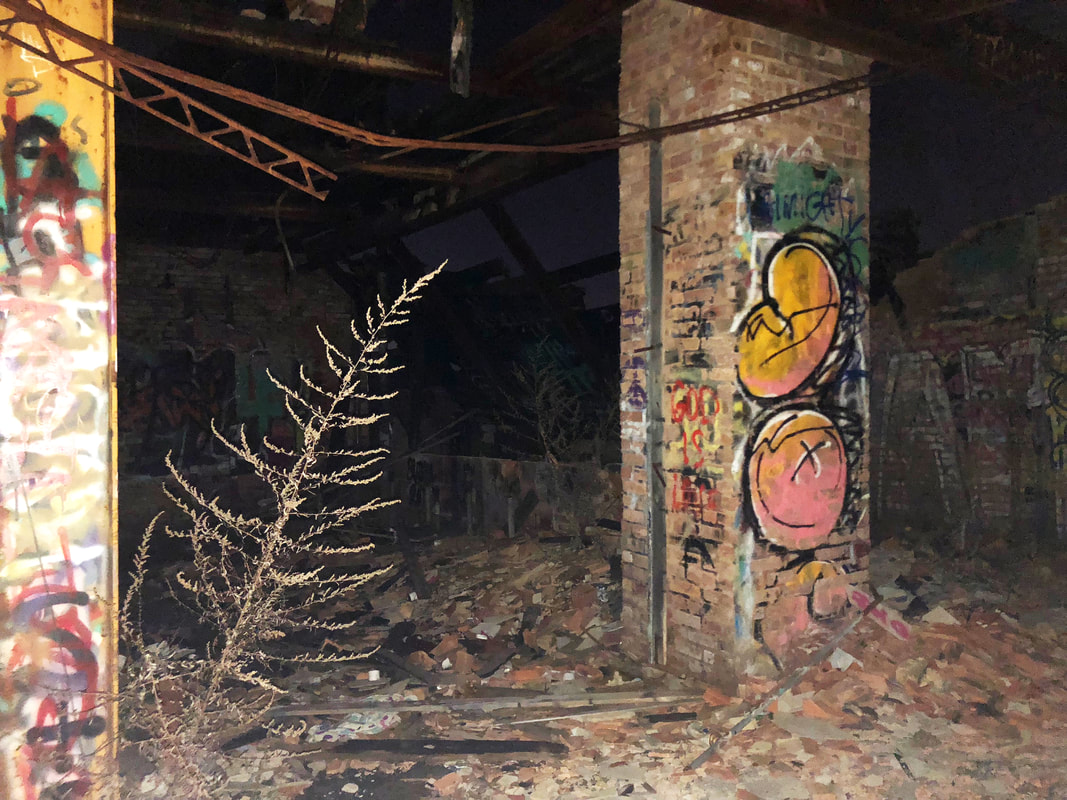
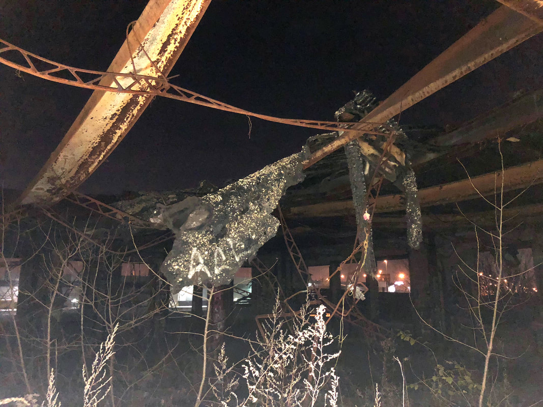
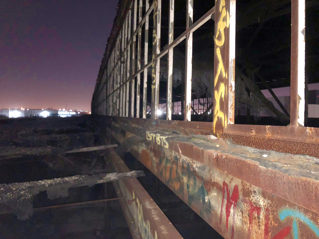
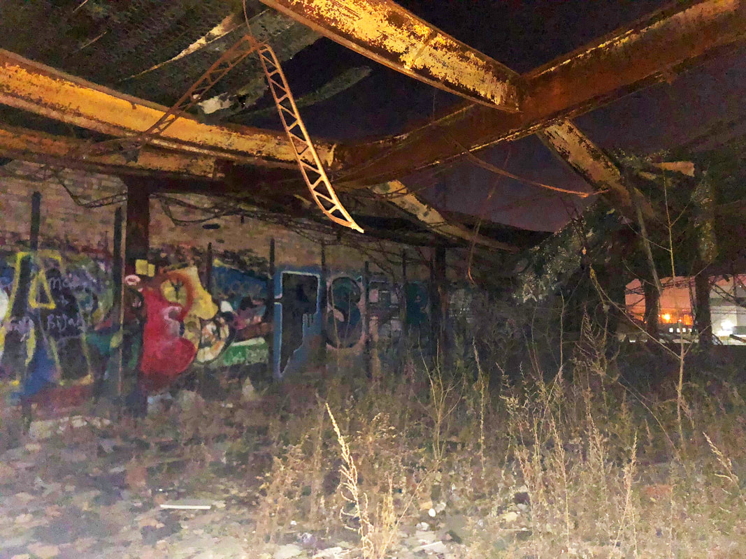
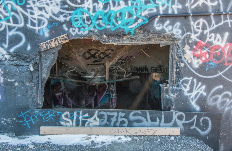
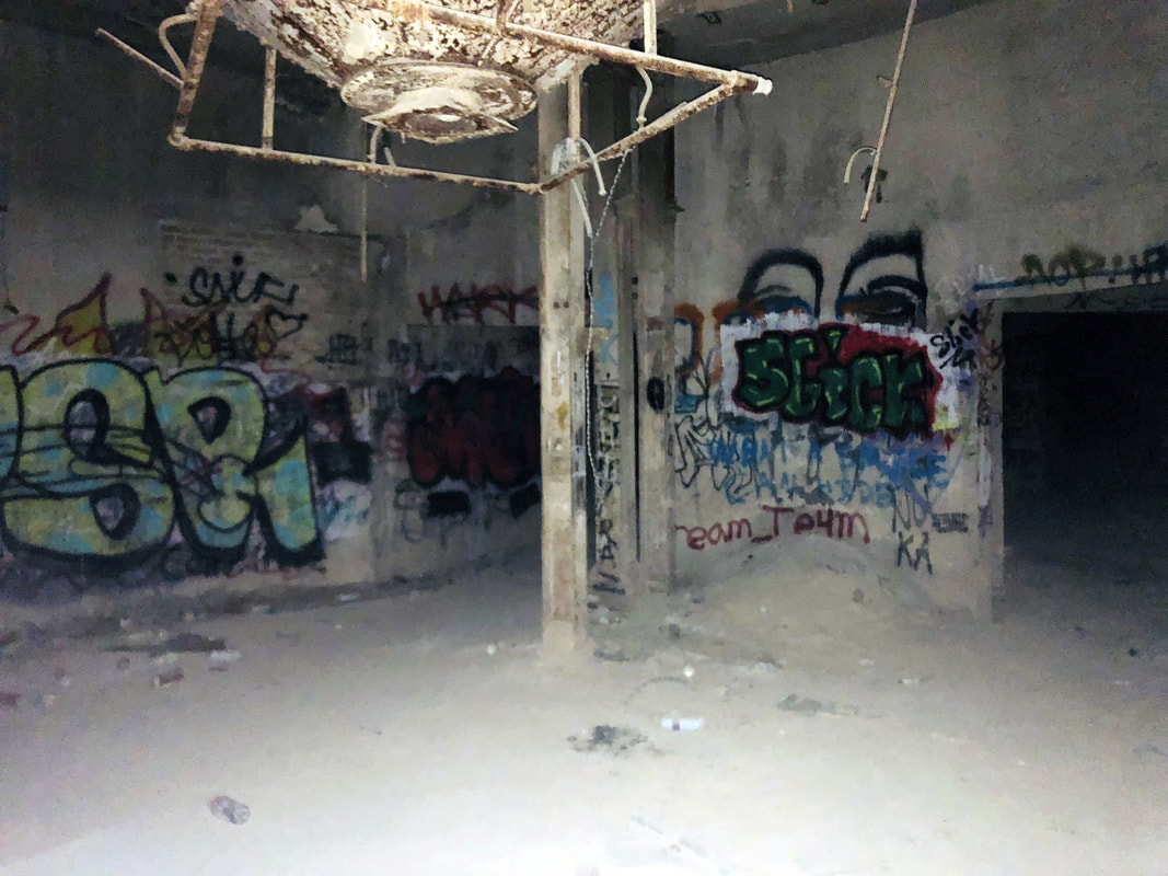
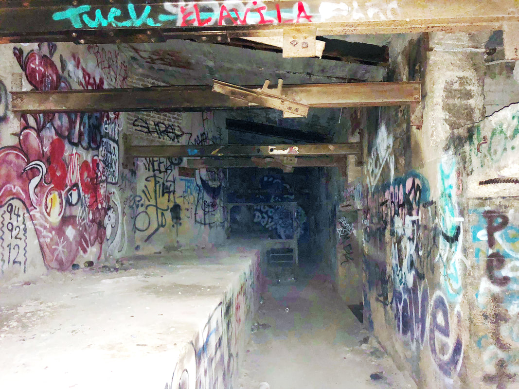
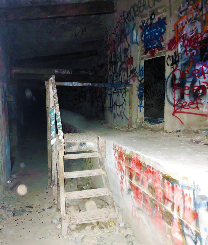
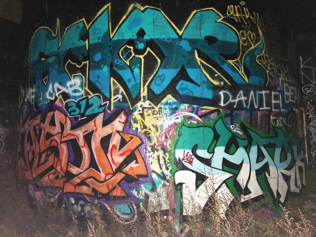
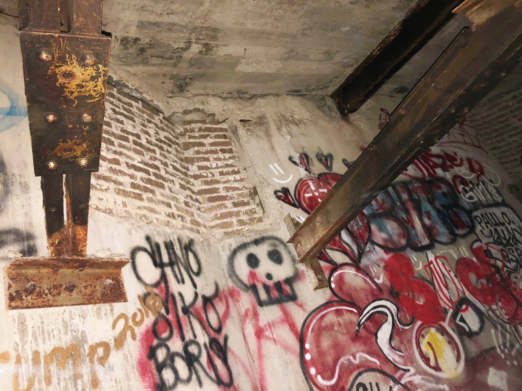
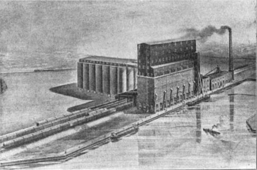
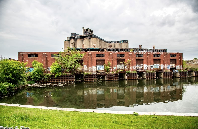
OverviewWelcome to my favorite adventure site in Chicago, the ancient Damen Silos! Located at 2860 S Ashland Ave on the south branch of the Chicago River, they're relatively easy to get to without being super public. The easiest way to access the Silos is by taking the Orange Line on the CTA 'L' train to Ashland. If you are driving, this website gives detailed instructions for parking at a nearby Target. From the L stop (or parking lot), walk through the business park until you're halfway down the fence and crawl through the hole directly across from the warehouse. You should see something similar to the images above - that's how you know you're at the right place. Once inside the fence, you can explore the abandoned warehouse and silos without much trouble, as long as you keep inconspicuous. The WarehouseOffering its own sort of adventurous charm, the warehouse has three crumbling floors of colorful graffiti and artistically-disheveled metal. If you were a fan of Milwaukee Wisconsin's Solvay Coke & Glass factory (rest in peace, my friend), you'll absolutely love this place. The building is almost identical in structure. The SilosClimb in through the hole pictured above (located on the silos' north side) and explore the cavernous tunnels of the silos! The amount of rooms and walkways seems endless, so be careful not to get lost. If you have stronger upper arms than me, you can probably climb to the top on the rope, too. It's located on the building's exterior on the river bank side, accessible and hidden from view. Safety and RiskIf this place's risk-of-getting-you-arrested was on a five-star system, it would be a solid two. There's a security guard that patrols the site and does a few rounds at night, but he's fairly easy to avoid. He sits in a car with a flashing green light at the top, but he'll turn off the light if he's trying to sneak up on you. I haven't been caught by him, but some friends who have said he just gave them a stern warning and told them to leave. Doesn't sound too risky to me! Nevertheless, be careful swinging your flashlight or taking pictures with flash if you're visiting at night. The windows in both locations make it easy to give yourself away. Some HistoryI know WAY TOO MUCH about this wild place. How much, you ask? Click here to read one of the longest essays I've ever written about the history of the Damen Silos. It's entertaining, I promise.
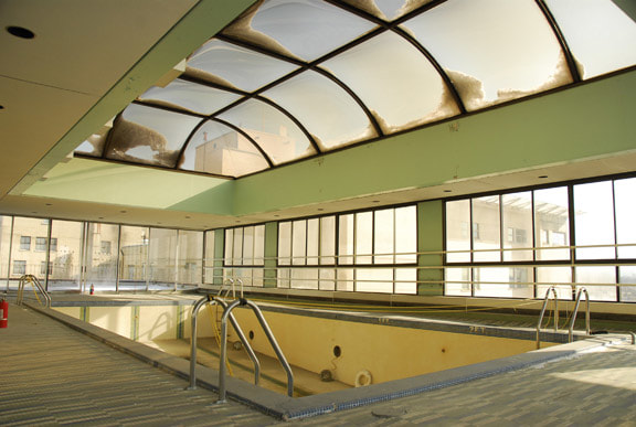
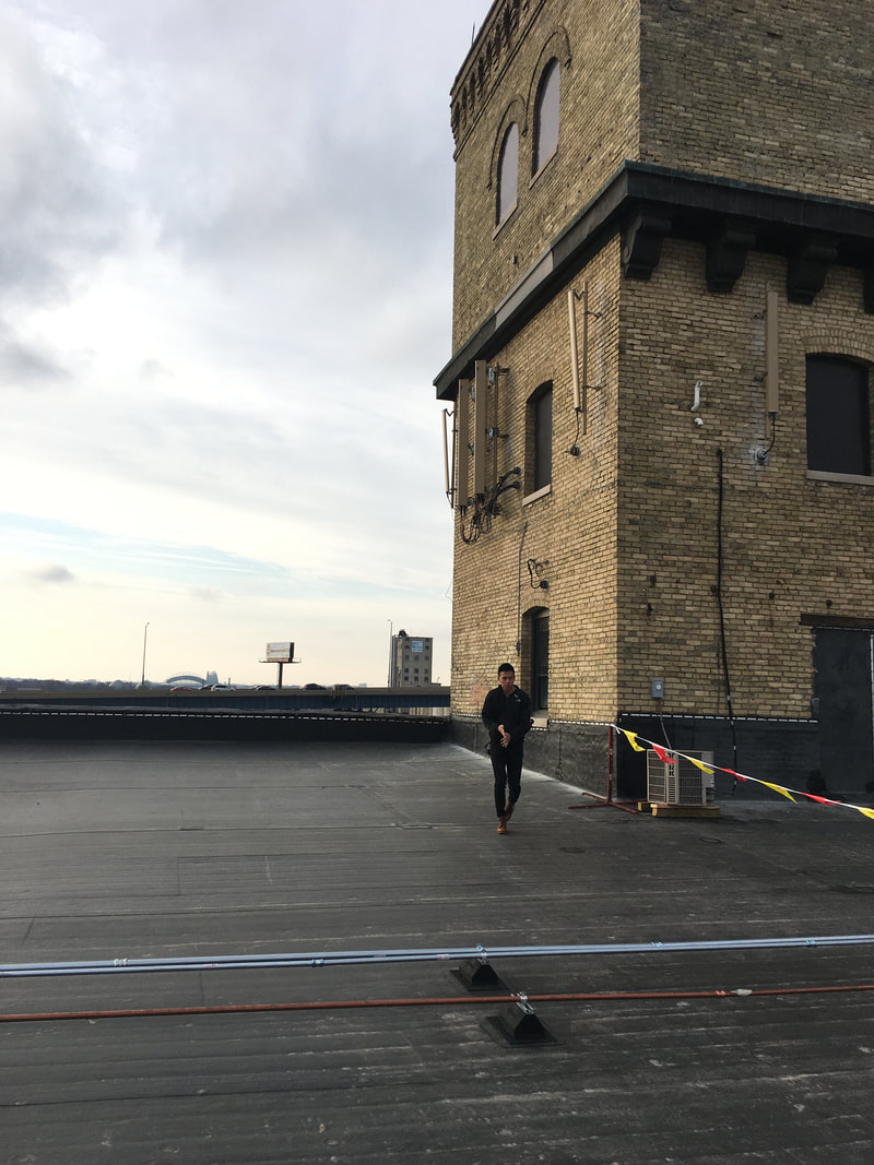
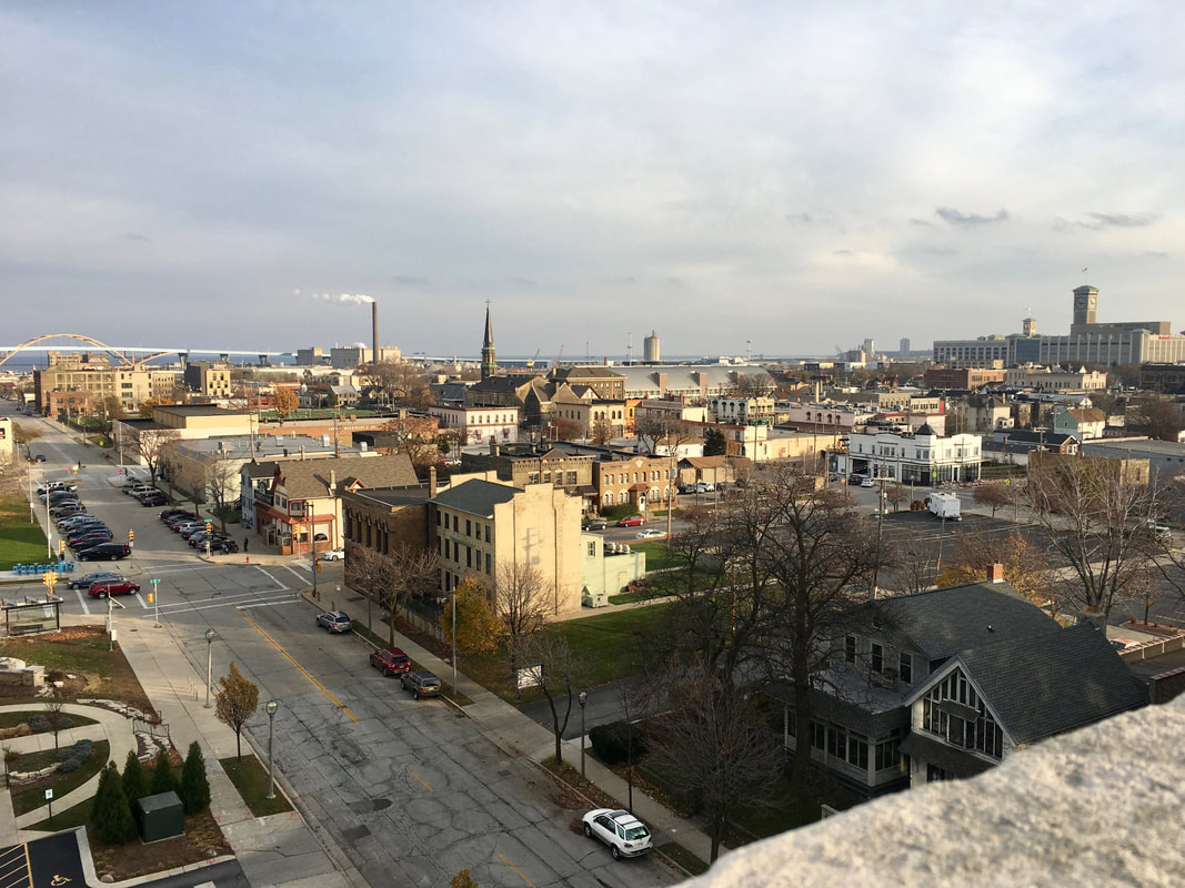
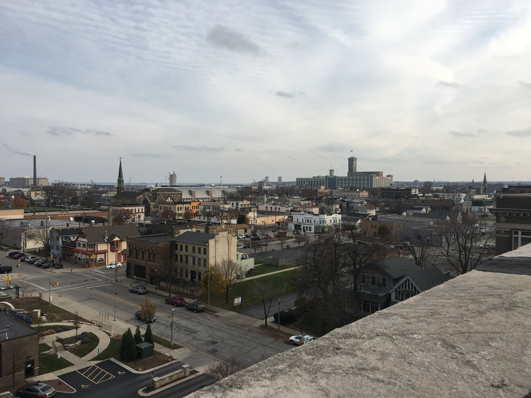
 This was for sure one of my favorite adventures, but it's tricky to duplicate. To access the roof, you've got to walk in the front doors of the Tannery, which is an office building. A really, really nice office building. Once in there, you can take the stairs to the sixth floor and go into the (unlocked, almost always) boiler room. There's a window in there where Riley and I rigged the screen, so it comes off if you just pull. Then, climb through the frame and descent onto the roof. Voila - you're welcome. More Pictures
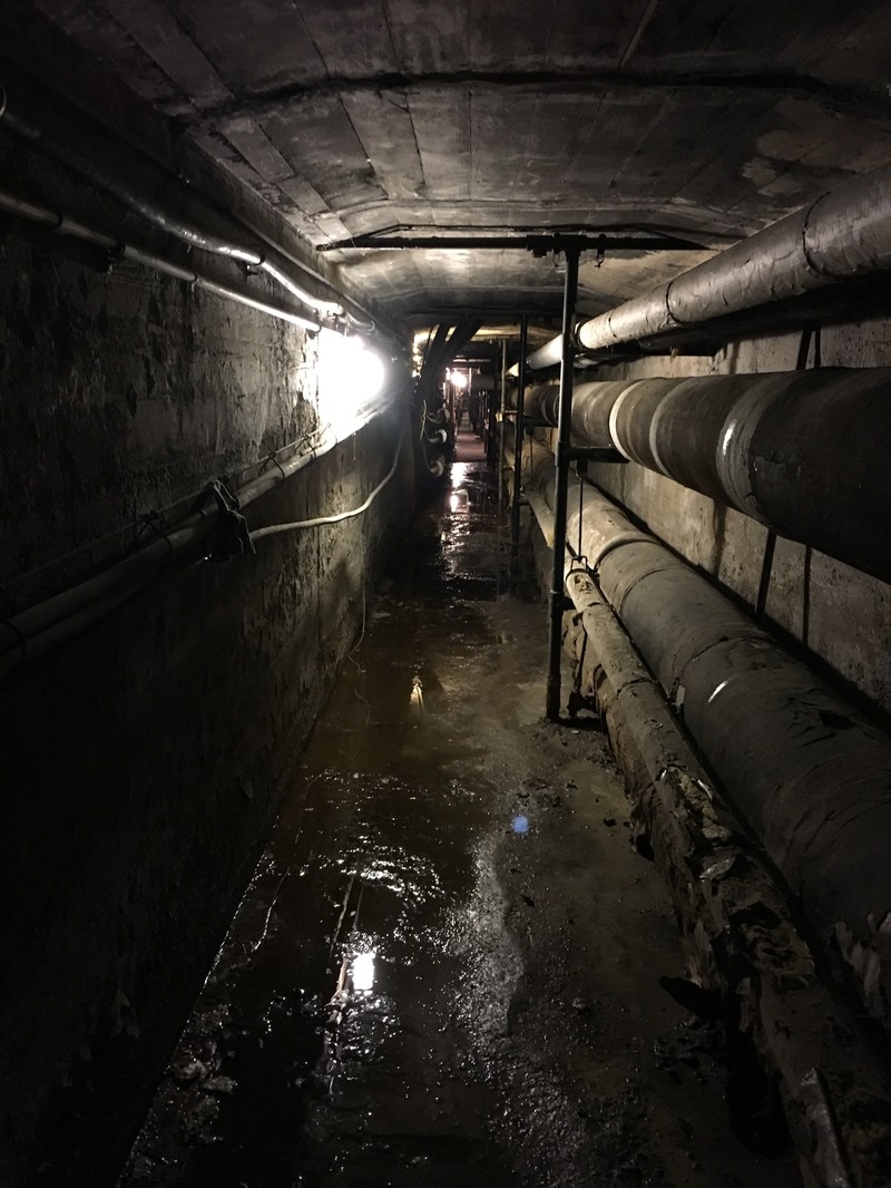
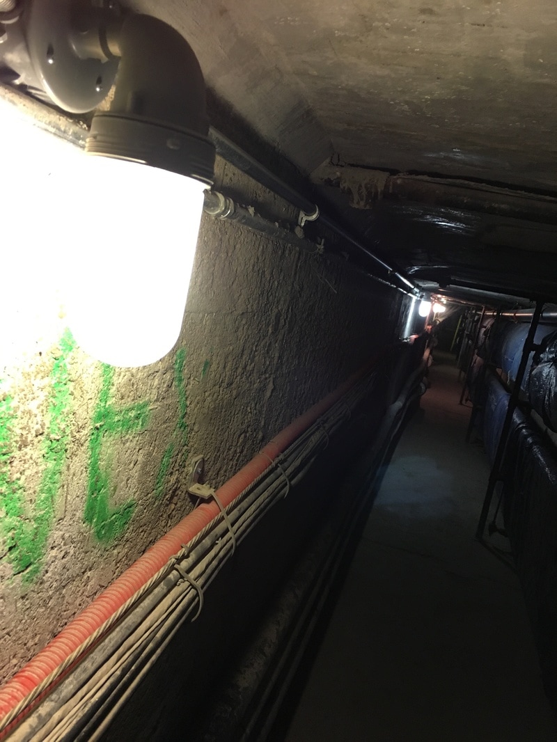
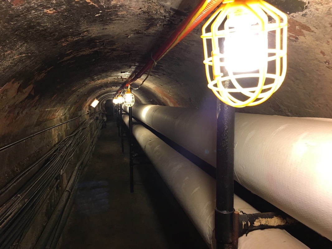
OverviewA lot of universities have underground tunnels built to allow students to walk between classes in subzero temperatures. Northwestern isn't one of them. Our tunnels are strictly off-limits to students, but that doesn't stop literally everyone with a taste for adventure and an iPhone from finding their way down at one point or another. Walking through these can take you from the observatory on North Campus to Fisk Hall on South. It's also insanely hot... and incredibly cramped. InstructionsThe easiest access point is an air vent outside of the observatory. Make your way to the green, tent-shaped cover hidden behind the row of bushes and pull it off to reveal a ladder down into the tunnels. Be very careful not to touch any uncovered pipes with your hands or you will be burnt! If you are sneaky enough, you can climb down the pipes without hurting yourself and get onto the ground into the first tunnel, pictured above. From there, keep walking until you reach the end or leave through one of the many other access points. Remember to close the one you went through on your way in!

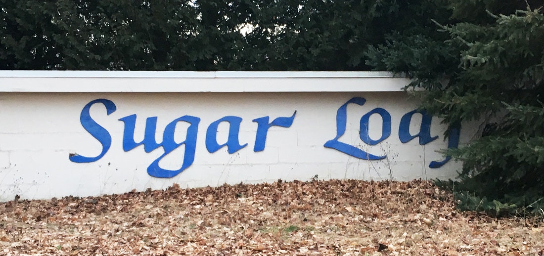
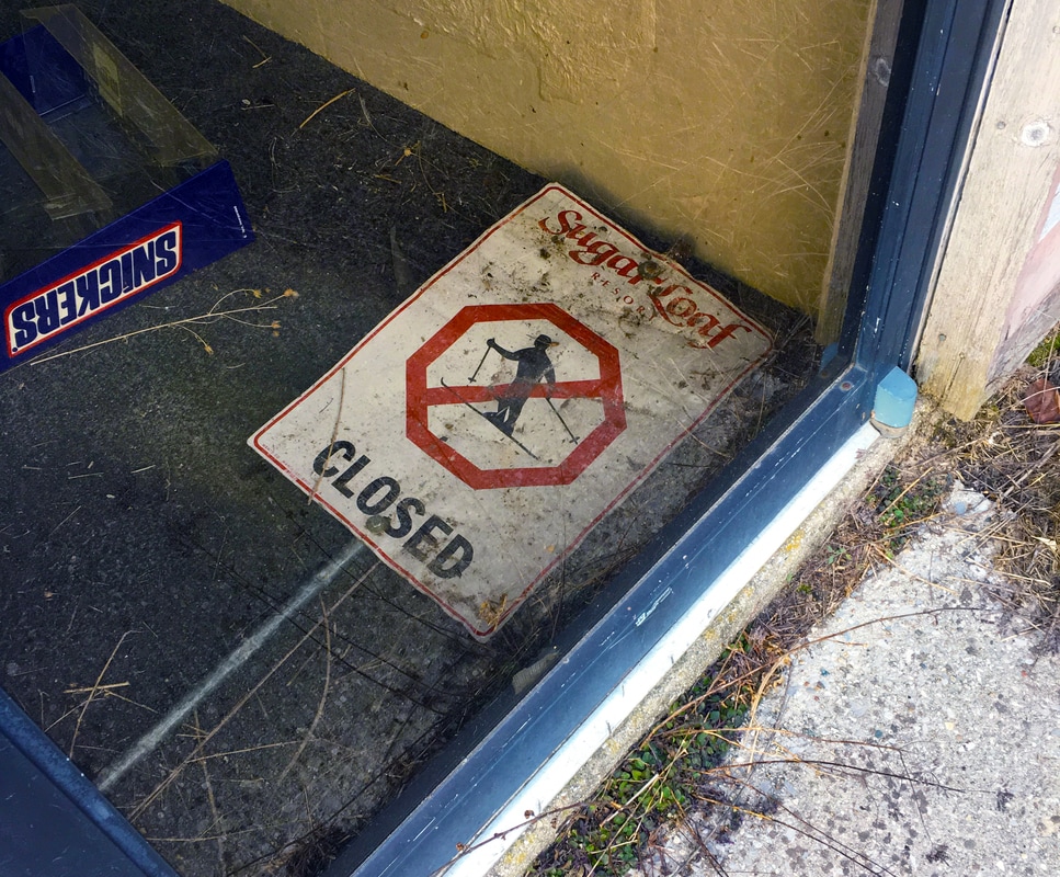
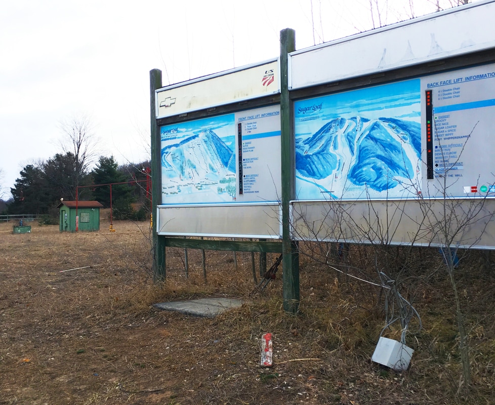
OverviewThere's not many places you can explore where you're confronted with the actual history of the site rather than the depth of your spray paint cans or scope of your camera lens. This abandoned ski lodge, still filled with hastily-scribbled paperwork, snow-stained lift tickets, slightly-faded race bibs, and sun-washed vintage posters brings to mind the memories of a real, living and breathing business in the way that a completely-trashed elementary school hopelessly covered in graffiti does not. The bedrooms here are still made up - sheets tucked in and trash cans emptied as if they could accept residents tomorrow. The room that was once the dining hall still has empty cases of soft pretzels and slushie machines, logos familiar enough to be seen in a modern cafeteria. The route map outside proclaims most of the runs to be open and plowed, despite being closed and empty for years. This place was abandoned, it seems, instantaneously - leaving an ever-present snapshot of that moment in history. Finds like these are a gem in urban exploration, rare to exist and even rarer to find. Welcome to Sugar Loaf mountain.
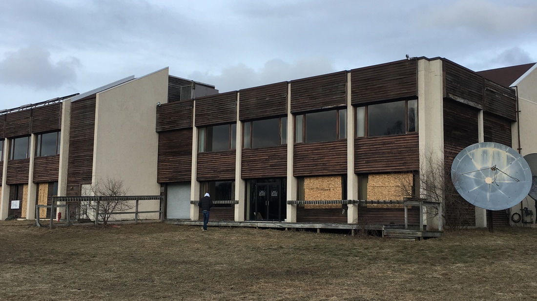
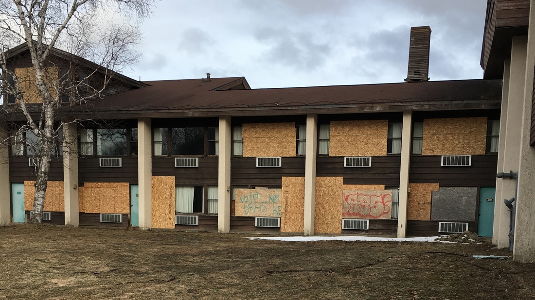
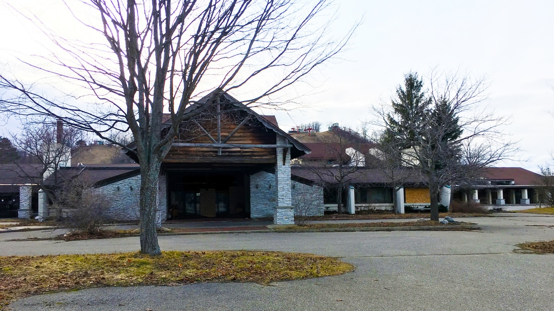
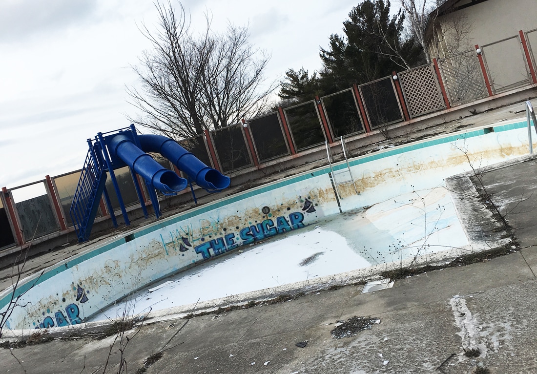
Location LayoutThe resort itself is fairly large with an open reception center and banquet hall in the front, ski rentals and dining hall in the basement, hotel rooms in a wing to the left, and a sad-looking outdoor pool to the back. Behind the initial lodge is the mountain, which boasts black diamond runs on the facing side and easier slopes over the back edge. The Resort LodgeThere are tons of doors on the lodge that appear as if they could be opened fairly easily with the right tools, but you don't need anything other than yourself to climb through the back window on the mountain-facing side of the resort. You will find yourself inside of an old office-type room once entering, filled with closets of vintage memorabilia and more scattered paperwork than they use for the school's-out scene of a high school movie. After digging around for souvenirs to take home, the door opposite from the window should lead you into the rest of the building.
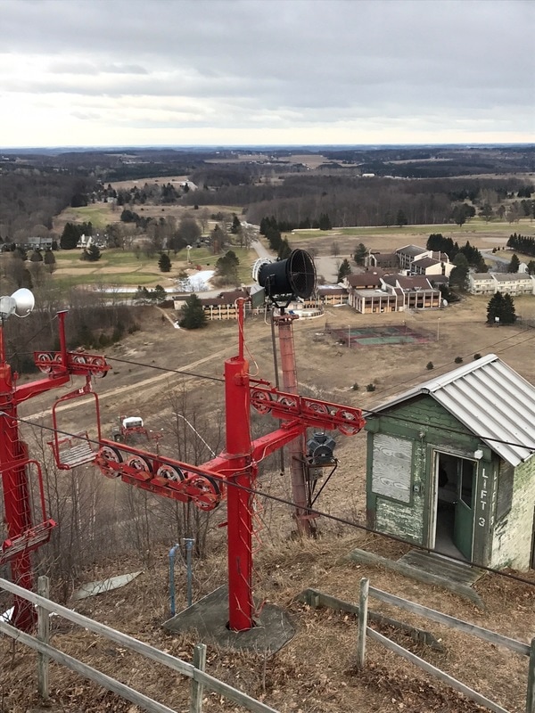
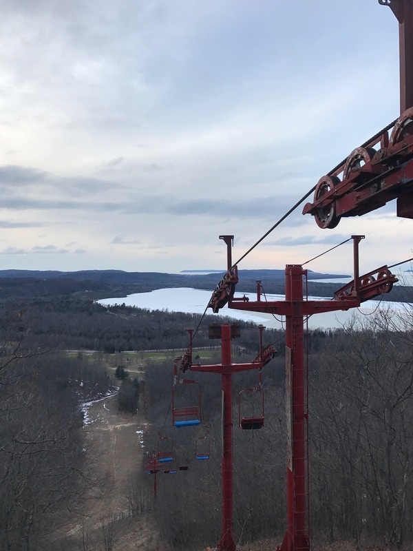
The MountainThe interior of Sugar Loaf is cool enough to be its own adventure, but don't leave before climbing to the top of the mountain itself. You're going to have to make the hike up a black diamond slope without the help of automated lifts (although five of them sit, vacant, to mock you), but the view at the top is worth it. Bring paint pens or Sharpies to deface the old lift lodges with dozens of other young explorers, adding to the list of inspirational messages along the lines of "hit me up if you like it in the butt" and "dude, call your mom."
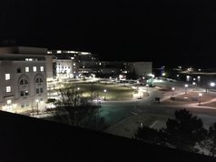
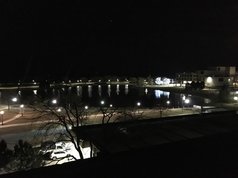
OverviewOne of campus' few accessible roofs, Swift Hall is a central location on campus to climb and explore. This can be a good thing, because it offers a unique view of Northwestern at night, but it is equally dangerous. Do not visit this location during the day as visibility for students on the ground is very high. If you see someone that appears like they have spotted you... you probably want to climb back down *swiftly*
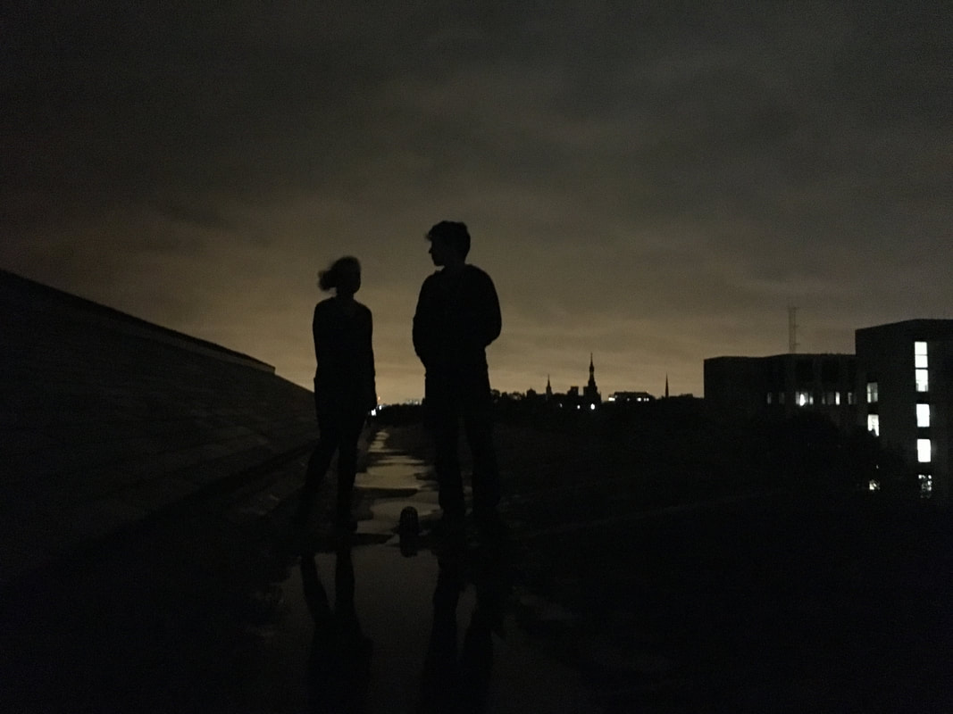
Snapshots from the top
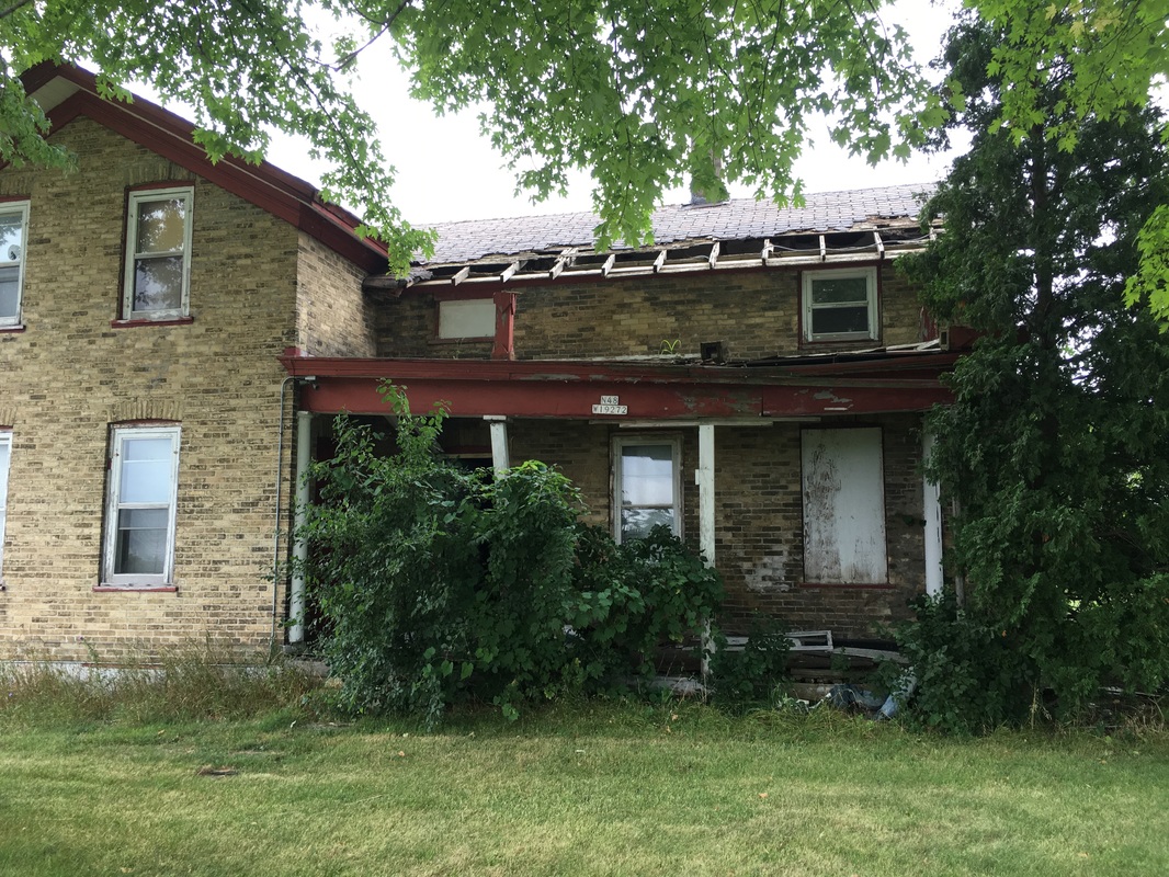
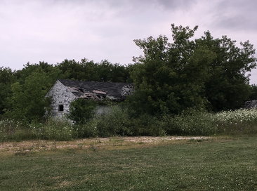
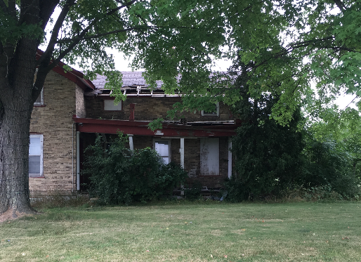
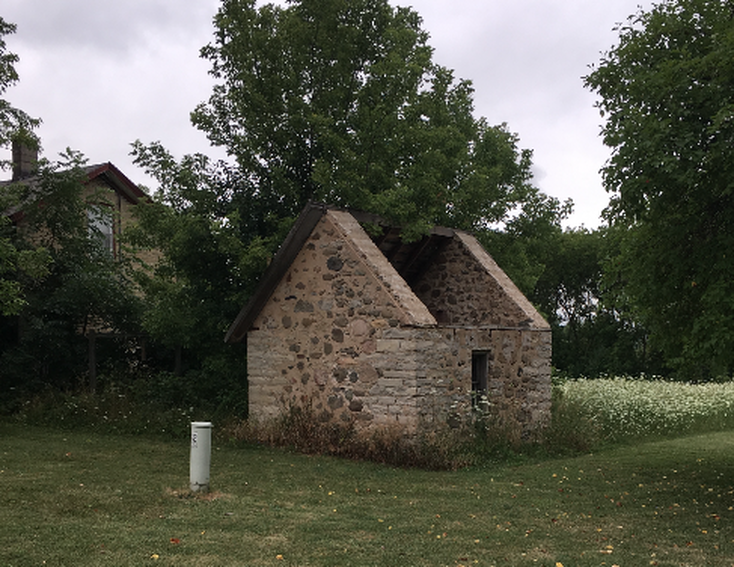
Directions + parkingDrive or walk to the Brookfield Soccer complex on Lisbon road, found after taking a left off of Capitol coming from Sendik's. Park on the street on One Mile road or in the Brookfield Soccer complex parking lot for the easiest access. You'll see it right away - below are images of the front and side of the house and its two small barns.
Have you been to this property? What did you think? Leave any tips of your own or observations in the comments to help other explorers.
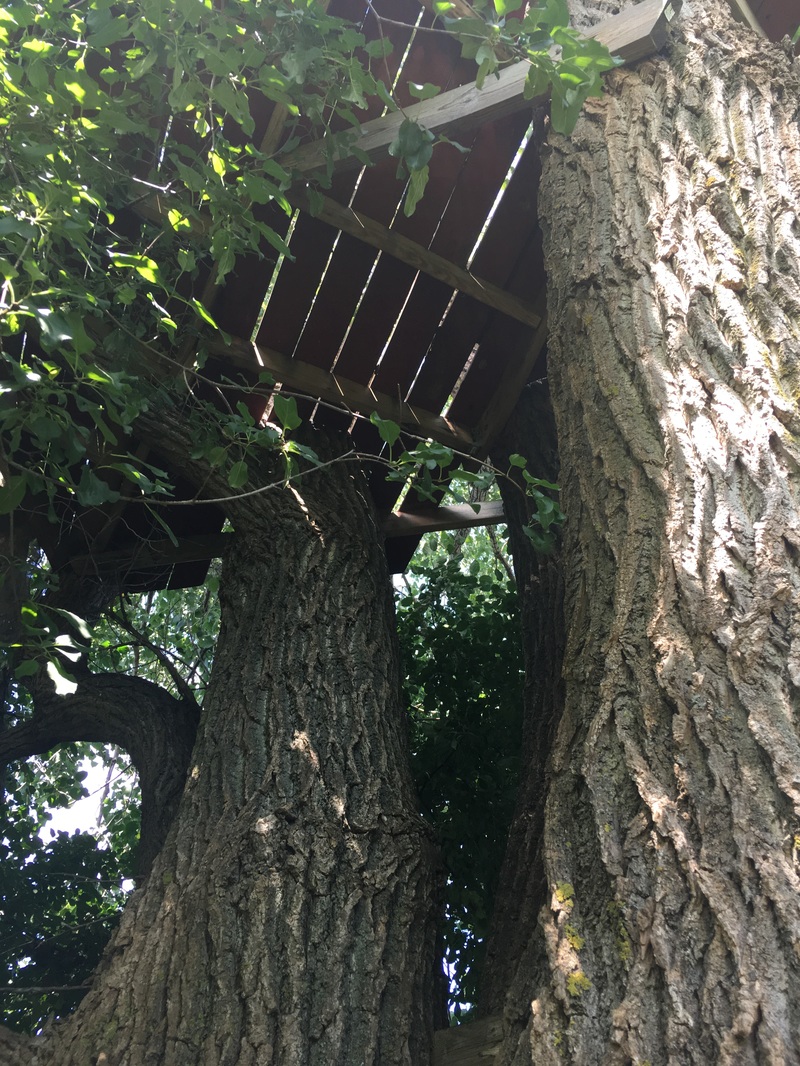
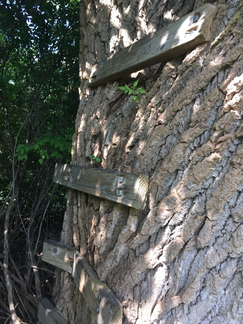
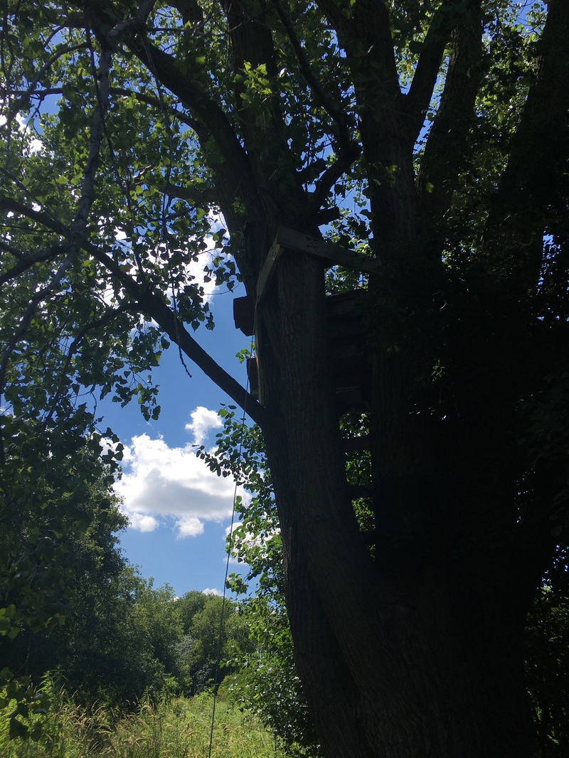
OverviewNext time you're by Storms Driving Range, walk around to the back and take a right to see the most well-built tree-house I've yet to explore. A second, smaller one lies nearby, but the first treehouse is where it's at. Warning: you'll have to cross a river to get into the field, which lies beyond Storms, unless you cross the grassy ridge in line with the middle of the driving range.
Have you been to this site? What did you think? Leave any tips of your own or observations in the comments to help other explorers!
|